- History
- The route
- Rallarvegen with children?
- How long will it take me?
- What to bring?
- Watch out!
- Camping
Rallarvegen, following the outskirts of the Hardangervidda Plateau, leads you along the Bergen Railway Line from Haugastøl via Finse, Hallingskeid, Myrdal and down to Flåm. It is also possible to continue down to Voss. The road itself is an attraction, and it takes you through a fantastic highland landscape starting at 1,000 meters above sea level (a.s.l.), peaking at 1,350 meters, before descending to the fjords at sea level.
For updated info about Rallarvegen, visit our Facebook page: Facebook.
Rallarvegen as a bike route
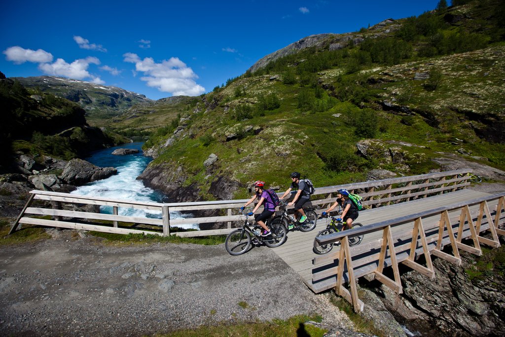
Rallarvegen was opened for cycling in the summer of 1974. In the first few years, only a couple of hundred cyclists rode the route from Haugastøl to Myrdal. Since then, the numbers have increased rapidly. In recent years, we estimate that around 25,000 cyclists from Norway and abroad ride Rallarvegen each year.
History
The construction route known as “Rallarvegen” is a more than 100-year-old man-made transport road, built to convey men and materials during the construction of the most mountainous sector of the Oslo–Bergen Railway Line.
The railway workers’ road is a cultural and historic monument. From this road you will always be close to, and often see, the Bergen Line, which was opened in 1909. You will discover painstakingly detailed work in stone and earth, carried out by a workforce that at its peak comprised 2,400 men. You will see line inspectors’ houses of high architectural quality and get an impression of Norway’s loftiest place of employment from 1900 to 1964.
It all started when the Norwegian Parliament decided in 1894 that a railway connection was to be built between Bergen in the west and Christiania (the former name of Oslo) in the east. The railway would cross the mountain range that splits southern Norway in two, and to do so they had to build construction roads leading up onto the plateau from Voss, Flåm and Geilo, and along the route the railway would follow. This soon became one of the most demanding railway projects in Europe. Everything needed—supplies and equipment—had to be transported from the villages up onto the plateau. Every day throughout a hectic summer season, hundreds of horse-drawn carriages transported the materials and gear required for the work to be carried out in the highlands.
“Rallar” was the name of the workforce, which later gave its name to this famous construction road: Rallarvegen. The Bergen Railway Line was officially opened on November 27, 1909. In 2009, the railway celebrated its 100-year jubilee.
The season
In these high mountains there are usually large quantities of snow, and along the Finse–Hallingskeid stretch—where snowfall is heaviest—there is no snow clearance service. Early in the season (i.e., in July, or after a snowy winter), we therefore recommend travelling the Finse–Hallingskeid sector by the Rallar train. Scattered sizeable snowdrifts, up to 100–200 meters in length, can also occur east of Finse and west of Hallingskeid.
July/August and weekends in September are peak season, so we recommend pre-booking your trip, including rental bikes, train and accommodation. Weekdays in late August and September are calmer since Norwegians are back at school and work—so if you are travelling from abroad, we strongly recommend cycling on weekdays. An added bonus in September is the fantastic autumn colours in the mountains.
Please see our "Rallarvegreport" page for current road conditions.
The route
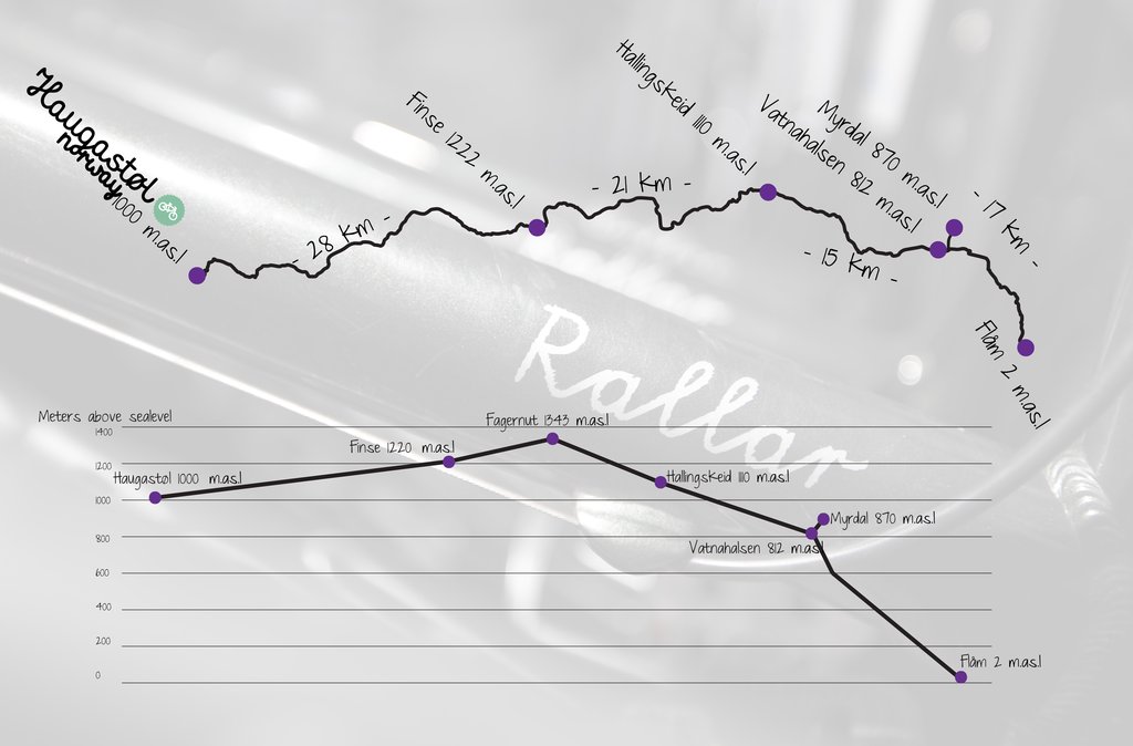
Haugastøl - Finse 27 km

You can start the trip from Haugastøl Train Station. Trains from Oslo and Bergen stop here regularly, and there is public parking. From the station you follow national highway RV7 to Haugastøl Turistsenter. You can also find public parking across the road from Haugastøl Turistsenter. Our “all inclusive” package is a popular option if you want to book the whole trip without the hassle of booking bikes, accommodation, food and trains separately.
Rallarvegen starts just outside Haugastøl Turistsenter. It rises 222 meters over 27 km up to Finse. Along the road you will ride through fantastic mountain highland nature and see many impressive 110-year-old man-made bridges, inspectors’ huts, and the Nygård Farm. Nygård Farm used to be the only farm at this elevation still in operation until the mid-1900s.
You will also pass Storurdi Lake and the Storurdi Inspector’s Hut at 1,105 meters a.s.l. After this you ride past Oksebotn at 1,160 meters a.s.l., an ancient summer farm used by farmers from Ulvik. You will see the new, modern railway track built to withstand the speed of future trains. A new tunnel, Gråskallen, has been built, and you pass snow screens designed to keep snow from covering the tracks during harsh winters.
Finse lies at 1,222 meters a.s.l. and is the highest railway station in Norway. Here you will find many possibilities for nice hikes, such as the trip to Hardangerjøkulen, the glacier just west of the station. We highly recommend a guided tour on Hardangerjøkulen with Jøklagutane if you have an extra day in the area.
A visit to the Rallar Museum is almost mandatory when cycling Rallarvegen. Detailed and useful information on the story behind the Bergen Railway is found here. It shows how the men recorded snow depths, planned and staked out the route, and the tools and equipment used to ensure construction could continue. The museum is situated in the house east of Finse station. If you wish to spend the night at Finse, it is possible at Finse 1222 and Finsehytta.
Finse - Hallingskeid 21 km
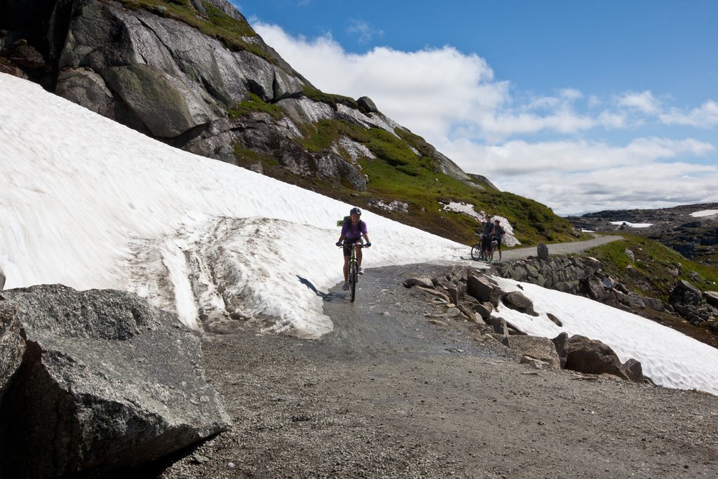
When you cycle west from Finse, you will glide into the beautiful natural surroundings of Hardangervidda National Park. Take your time and enjoy the landscape. It's hard not to be impressed by the magnificent mountains around you and the view of Hardangerjøkulen glacier with its great cape of white and blue eternal ice.
If you are lucky you might spot wild reindeer or the white Arctic fox in this area. If you see them, please keep as far away as possible so you don’t scare them. Ride slowly so you don’t miss the beautiful highland flowers along the road.
You can see traces of how families once lived while battling the weather for years just to keep the railway open in all conditions. You will pass inspectors’ dwellings at Sandå, Slirå, Fagernut and Grjotrust. Fagernut is situated at 1,310 meters a.s.l. and is the highest inspector’s dwelling in Norway; families lived here between 1904 and 1964. You will also pass Fagervatn Lake, the highest point on Rallarvegen.
In summer, a café is run in the Fagernut dwelling, where you can buy freshly made waffles and coffee. The building is restored using the same techniques and interior style as when it was built.
Hallingskeid - Vatnahalsen 17 km
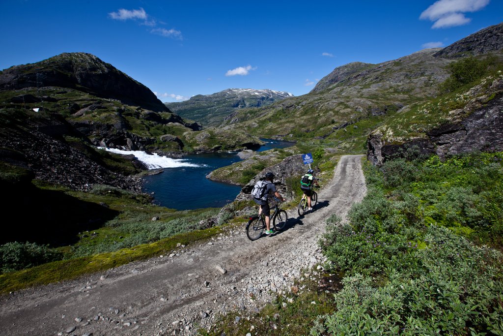
The first dwelling you pass is now a tourist cabin that is open for visitors all year round. Notice the grassy opening at the bottom of the valley. This used to be the site of an annual summer market up until the Black Death (link) in the 1300s. People came from nearby valleys and fjords—Hallingdal, Sogn, Hardanger and Voss—to sell goods, hold competitions, dance, drink and fight.
From Hallingskeid down the valley to Myrdal you can see how the railway follows a mountain shelf. Try to imagine how the workers built this section and the challenges they faced. This area is affected by many avalanches during winter.
Klevabrua is a beautiful and impressive bridge that you will notice before continuing into the wild and fascinating ravine, Klevagjelet. The road continues along a narrow shelf—so be careful and walk this part if needed. On your way to Vatnahalsen you will pass Seltuft, where you can see traces from the Stone Age.
At Vatnahalsen you will find a station on the Flåm Railway Line, as well as Vatnahalsen Hotel. At this point you must decide: continue down to Myrdal and Flåm, or turn off towards Voss. It is 2 km to Myrdal, where you can enter the train and travel both east towards Oslo and west towards Bergen.
Vatnahalsen - Flåm
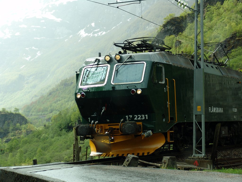
Flåmsdalen is an impressive valley with one of the steepest standard-gauge railway lines in Northern Europe: the Flåm Railway. It is 20 km long, has 20 tunnels, and an altitude difference of 865 meters. The Flåm Railway is world famous. Every summer almost 600,000 tourists travel the Flåm Railway, and around 100 cruise ships arrive in Flåm with guests visiting this famous route.
Rallarvegen makes its way through 21 sharp bends down to Kårdal, the highest farm in Flåmsdalen. From Kårdal the road continues through the wild Flåm Valley past Berekvam and Dalsbotten. From Dalsbotten down to Hårreina you will pass the powerful waterfall Rjoandefossen.
Make sure to stop by Flåm Church, built in 1667. The poet Per Sivle was born and grew up on the farm across the river from the church; you can see a memorial stone raised in his honour. On the last part towards Flåm you are cycling on the public road going up the valley, so take care and keep your speed down.
Flåm
Flåm Train Station is located at the end of the Aurlandfjord, one of the arms of the Sognefjord. During summer, Flåm is a melting pot of tourists from all over the world. You can hear many different languages and watch people heading off for new experiences by boat, bus or train.
You will find the facilities you need: hotels, B&Bs, campsites, cafés, restaurants and shops. It is possible to catch the train via Myrdal to Bergen or Oslo, or a boat taking you out the Sognefjord—southwards to Bergen or northwards towards Selje.
For those who chose the Bike package from Haugastøl (1,000 m.a.s.l.), a return journey from Flåm to Haugastøl by the famous Flåm Railway is included.
If you want to rent a bike to ride locally in Flåm and the surrounding areas, see flambikerental.com.
Rallarvegen with children?
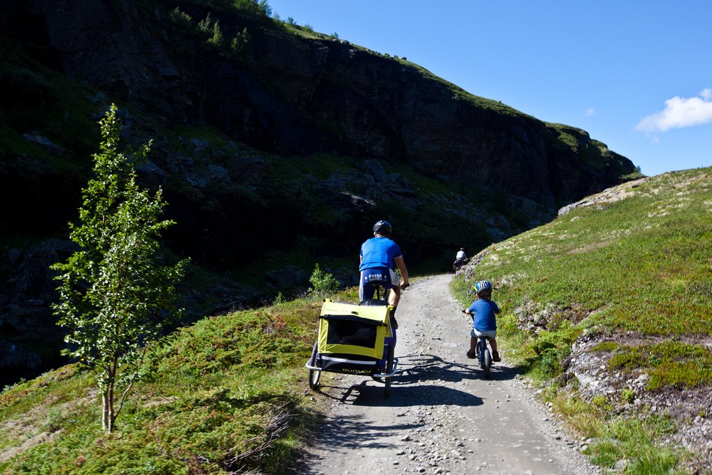
Rallarvegen is at times very steep, and the road is largely unsecured and demanding for children. If you want to ride the full route, we recommend that children are around 12 years old. That being said, we have seen 7-year-olds who manage well—and 16-year-olds who struggle.
Luggage trolleys and children are not recommended on the Finse–Flåm section.
The ride between Haugastøl and Finse is suitable for younger children. The road is in relatively good shape and not as steep as the Finse–Flåm route.
Every day during the season there is a cycle train from Haugastøl to Finse in the morning. Riding time back to Haugastøl is about 3 hours at a leisurely pace.
Watch out!
The “Rallarvegen” has many places where the road is in poor condition, and three rather perilous spots where utmost caution is required:
- Where you cross the railway track in the snow shed at Grjotrust
- In the Klevagjelet ravine, with its unprotected roadside and precipitous drop into the turbulent river below
- On the way down the notorious 21 hairpin bends in the upper end of the Flåm valley—dismount here, as there is a real danger of your brakes overheating and seizing up
How long will it take me?
Haugastøl – Finse: 3–4 hours (27 km)
Finse – Haugastøl: 2–3 hours (27 km)
Finse – Fagernut: 1 hour (10 km)
Finse – Hallingskeid: 3 hours (21 km)
Hallingskeid – Flåm: 3 hours (32 km)
Finse – Myrdal: 5 hours (38 km)
Finse – Flåm: 5–6 hours (53 km)
What to bring?
- If you bring your own bike, make sure you pack spare brake pads, an inner tube, patch kit, pump and a basic repair kit. If you rent a bike, this will be provided.
- A helmet is the cheapest insurance you will ever buy! (Great helmets can be bought at Haugastøl for 499 NOK.)
- Use waterproof panniers—heavy backpacks are NOT great for cycling.
- Good shoes: light waterproof hiking shoes, or running shoes with shoe covers (can be bought at Haugastøl for 349 NOK).
- Windproof and waterproof clothing is a must; the weather in the mountains changes fast!
Useful advice
- If you bring your own bike, book all train tickets in advance. There are only a limited number of bike spaces on the trains, and the trains that carry the most bikes are often fairly expensive. Haugastøl–Finse on the 10:25 train is 265 NOK per bike, Flåm–Myrdal is 280 NOK, and Myrdal to Finse/Haugastøl is 265 NOK. Total: 810 NOK per bike.
- Visit the Rallar Museum in Finse.
- A trip on Rallarvegen is a journey back in time. We want to protect and restore the road for future generations—bring all your trash to the next village and don’t leave it along the way.
Camping
In addition to the hotels along the route, there are good options for wild camping. There are a few restricted areas that are good to know about when planning your trip. The first 13 km from Haugastøl towards Finse, and the area surrounding Finse, are off-limits.
